17 October, 2015 - All week, the changing colors of the fall season visible in the majestic mountains of this western Virginia region continually called me to take my bicycle and explore. This saturday, I would finally find time to do so. However, the morning I had planned on going out, I had a flat tube. Upon putting a brand new tube in, I heard a terrible hissing sound. Buzzkill. Since my back wheel also needed to be trued, I took it into a shop. Unfortunately, I was not able to hit the road until 130 in the afternoon.
DOWNHILL ZOOM! Fall colors in a valley!
The New River Valley, that is!
New River Valley!
I'm riding on that New River - train --- err.. Bicycle
The view upriver where I decided to stop and take in the scenery.
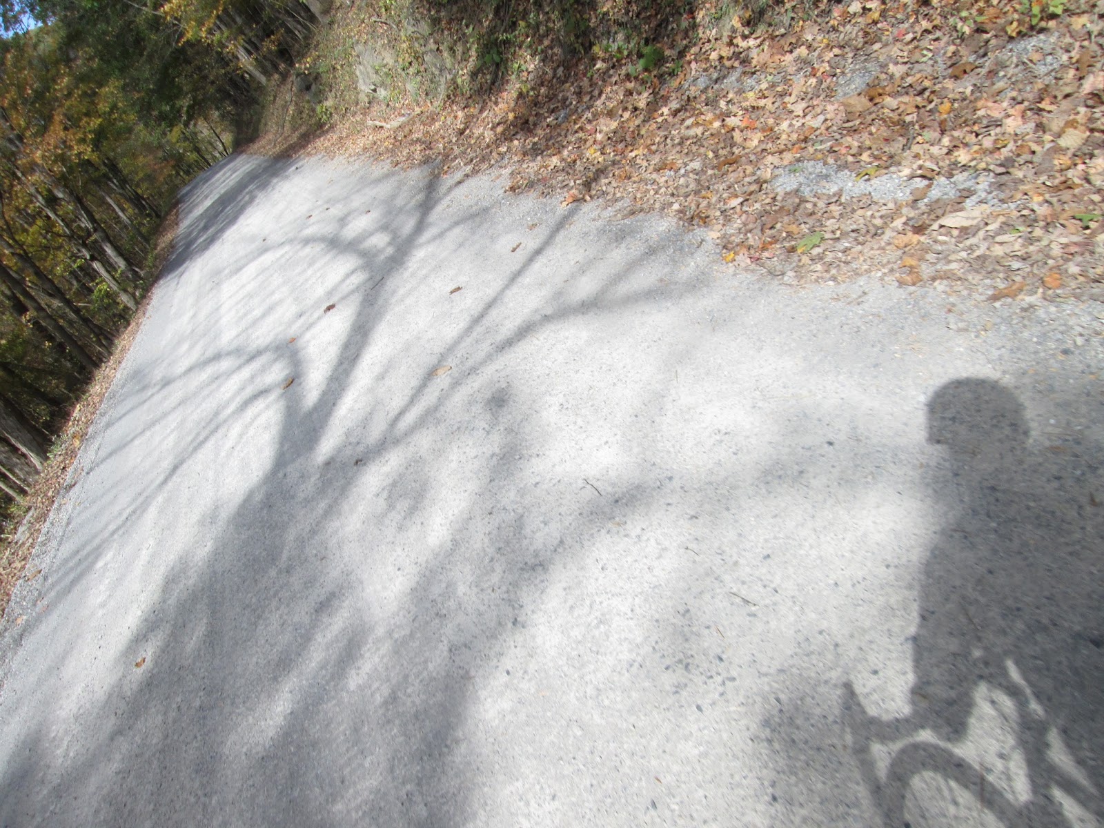
The path turned to this (I think) crushed limestone material when it turned away from the river. It felt like I was really out in the country at this point. It was a ton of fun on a 700x25 road bike.
Once I emerged over the hill from the river, my challenge revealed itself. While I had indeed done some cool climbs through the past, this one in particular was very menacing leading up to it.
A non-zoomed in view of the mountains ahead of me.
One interesting thing is that despite these towering mountains, I had to go downhill quite a long way just to get to the base of the mountains.
This is at the bottom of a hill before the mountain. Great paved road. Creek to the left. Fall colors.
Autumn.
The mountain. I was going up there. This would definitely be a long constant uphill battle to get up there. Keep these power lines in mind for later. There were two ways to get to Mountain Lake from the south. Mountain Lake Road is longer, but less steep, and very winding. I wanted to descend this. I decided to climb Doe Creek Road, which was shorter, steeper, but more direct.
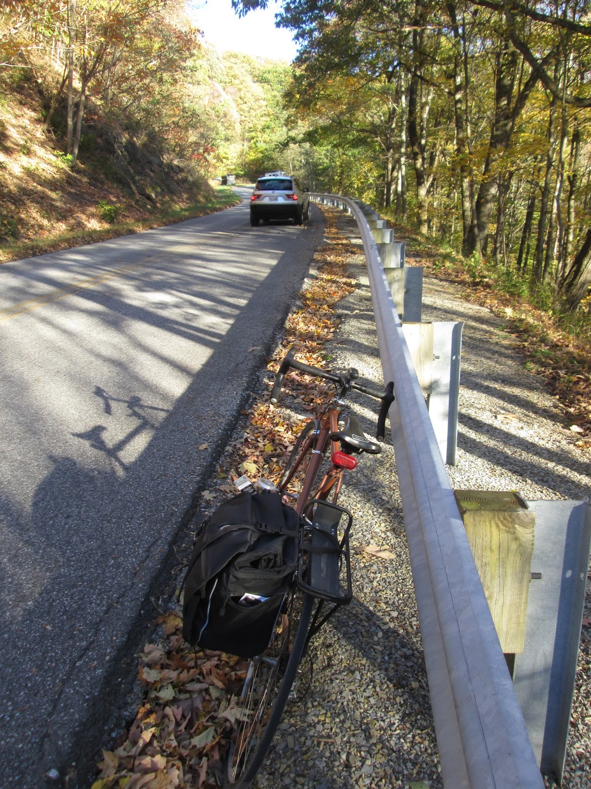
At one point, on my 8.5x11 printout map, I had indicated a line with a skull and crossbones next to it. This part of the road is slightly beyond that mark.
One thing I hoped to accomplish was to take a hike to the cascade falls, which as the bird flies, should not have been to far from this side 'road' (one lane, combination of fine and coarse gravel.) There were plenty of cars on this road, surprisingly. So I figured I was in the right place. There was a large climb to get to the high point of this road. Quite difficult.

At one point, I got over that and began descending, looking for a possible trail to the cascades. At this point, I was on the cold side of the mountain, and while holding the brake handles to control my speed on this rough road, my hands became quite cold. At one point, I made it to this creek. I looked at my map, and realized I had gone quite too far and was at least a mile upstream from the shortest straight line path to the waterfalls. I talked to a a driver who went past on this bridge, and he told me that all of this area was private property, and that the trail to the falls had an entrance in a much different place. He offered a ride back up the hill, but I told him I would be okay. I got myself here, I gotta maintain the integrity of the ride, haha... Silly me. One positive to this dirt road detour mistake, is that it bumped the mileage of the ride up to 62mi, or 100km, a metric century.
I figured this bridge would make a nice place for a photo opp.
The hill climb back up from the creek was terrible. The surface was rough, and the climb was quite long and nonstop. My hands were quite cold at this point. I was very glad to get back to the sunny side of the mountain and to nice paved roads. Except, the unpaved side excursion had tired me out quite a bit. I went up about a quarter mile and had to stop to rest. The grade was really steep. It was supposed to be around a 4 mile climb, with around 2000ft of elevation gain. The math means that it had to be at least 10%, right? I stopped for some food here (I had packed a loaf of Italian bread with me.)
With only a mile left of the climb (They have spray paint markers every half mile, showing distance remaining.), I felt like I really couldn't make it much more than 100 yards at a time of this. I decided to just walk to the top.
Yeah. This.

The summit looks alot closer now! I could see Mountain Lake Road, the normal way to get up here.
Reflecting on what I had to tragically walk up.... At least I rode at least 3/4 of it. (In addition to my dirt road.)
Thankfully, at the top of Mountain Lake is a resort. I went to this outdoors shop and bought a pair of gloves. I would be really happy about this decision on the way home.
Mountain Lake lodge with warm color evening sun and perfect fall colors.
I had also wanted to hike up to the summit, which was actually a hike I had done twice before. (Spring break on my visit to VT and as well as at the beginning of the semester.) However, I had to consider Bear Grylls. I remember that in addition to drinking my own pee (this I did not do), he told me that if I hold out my hand, each finger represents 15 minutes of daylight left. So according to Bear Grylls, I only had a half hour of daylight left over. Not enough time to reach the summit and take in the view. I had an instant flat tire this morning. Cascade Falls eluded me. I had to walk the last part of the climb. I didn't have enough daylight to hike the summit. I would be riding back at night. It was a great day. Take that last sentence both literally and sarcastically, with a stronger lean toward literal.

I assumed that this was the best mountain view I would get. I decided it was time to enjoy the decent down Mountain Lake Road.
Though there were a couple breaks in the woods close to the top. I had to stop and take in these views.
After all, this is a sunset from a mountain!
Fall colors: maximum!
Remember those power lines? They're back!
I had a bunch of awesome zoomed in photos. Unfortunately many aren't published due to that little black dot in the middle. If anyone has any suggestions on how to clean this from my camera, feel free to let me know! This one was just too darn good not to publish. God sure does make some beautiful things. People are included in that. And like God, we can also make beautiful things! (like these power lines, without which, this view would not be available.) Slightly sarcastic, (yet not) parentheses comment there, this is one good approach to some of the reasoning and philosophy of the architectural profession. (Perhaps... I'd be interested to hear different views on the subject. I just like looking at God as being the master architect of the whole world. He does a much better job of designing things than we do.)
I feel terrible for taking this. I feel even more terrible for including it in this post.
The descent was incredible. Rivals those of Italy for sure. the downhill steepness kept me going really fast. Typically, the curves were pretty tight, but banked, so I didn't have to do too much hard breaking, which made going through those turns pretty darn fun, especially when there weren't guardrails, or deer up ahead. The bits of sun creeping through the autumn leaves made it very scenic. When I got back to the apartment, Aaron told me I needed to get a GoPro camera for stuff like this.
This photo was taken from Eggleston Road, looking back of the mountain that I (sort of, or at least would like to think I) conquered. (Or perhaps was conquered by...)
One interesting phenomenon was the temperature difference. Up on the mountain it was quite cold, even in sunlight. However back at the bottom, it was much warmer. I had to remove my jacket.
After this photo, it was pretty much night riding. The dirt road back to the New River was a lot of fun at night.
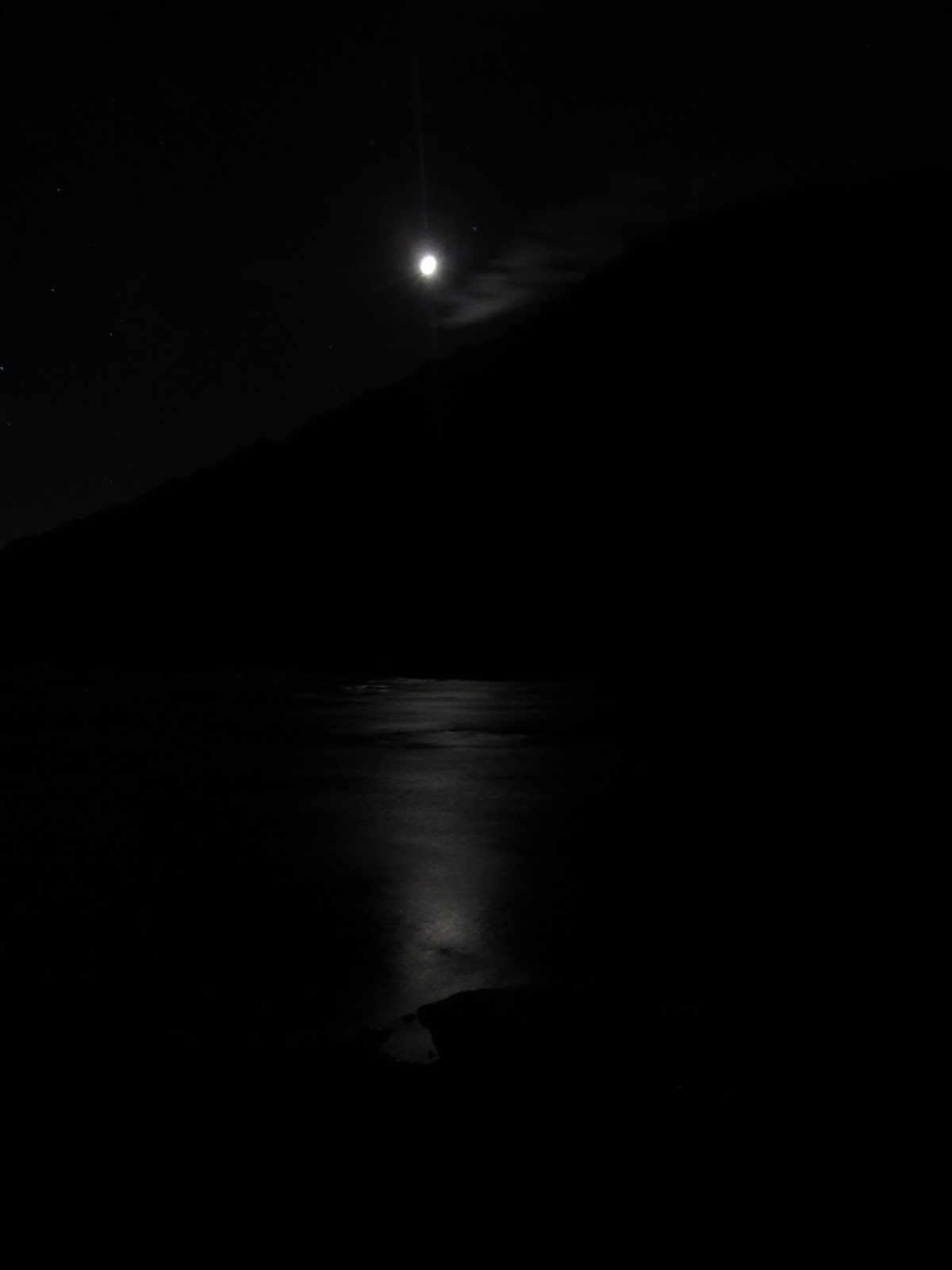
Photos don't do this justice at all. This was even taken with a 15 second shutter. The moon was only a crescent. The stars were in massive abundance, and there was a most wonderful twinkling of moonlight on the New River, with a mass of blackness in the background that made up the form of the mountain on the other side.

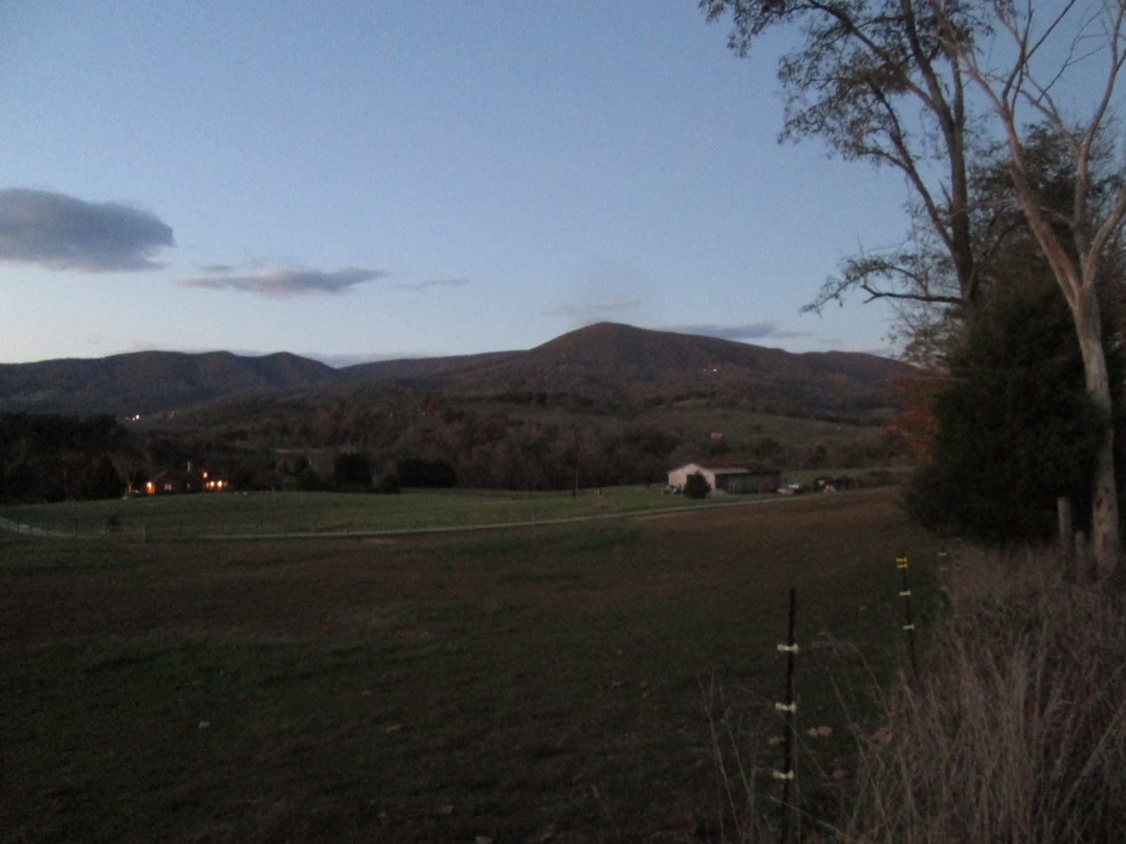
In Blacksburg, you can mostly see mountains on all sides. Which completely creates the illusion that Blacksburg is in a valley. However, all the ways in to Blacksburg are uphill. The University town is definitely on a plateau. The climb back was pretty tiring, and it was at night. At one point, I was passed by a jankey old pickup truck, who loudly sped by honking his horn, and hardly left any room at all. It made me so angry. Up about a mile ahead, I saw that pickup truck and its posse stopped at a gas station. I was tempted to yell in anger back at them, but I decided I didn't want to get shot, stabbed, or run over, so I kept going. In case they were coming my way, I cycled at a really fast pace back to town. I wanted to put as much room between myself and those jagoffs at the gas station as possible. They had already passed me once in the most terrible of ways. I didn't want to see what would happen if they had to do it a second time. Thankfully that would not happen. Unfortunately, it really did put a sour note on the end of this otherwise enjoyable outing.